
The park, and how it fits Buckeye
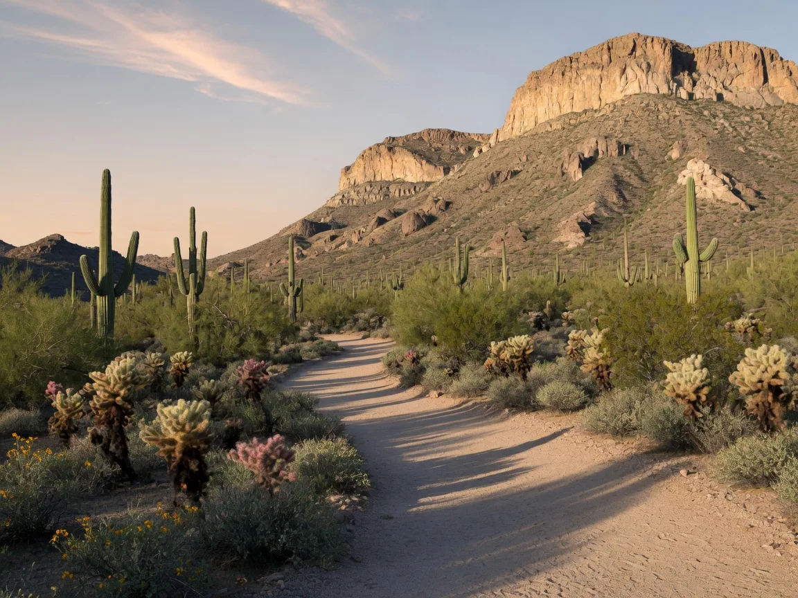
White Tank Mountain Regional Park is Maricopa County's largest desert park, roughly 29,000 acres of saguaro country at the eastern foot of the White Tank Mountains. The entrance is at 20304 W White Tank Mountain Rd in Waddell, a straightforward drive from the east side of Buckeye by way of the Loop 303 and Olive Ave. It is a Maricopa County park, not a Buckeye city facility, which matters for planning: hours, fees, trails, and closures all run on the county's calendar, and the county parks department is the authority to check before you go.
For Buckeye residents the park is the closest big desert escape. The White Tanks shoulder Buckeye's east side, and this is where the serious trail mileage lives while the town's own parks fill in. The details below were compiled and verified in late October 2026 from the county's published information, which changes, so confirm before you drive. The park's phone line is 602-506-2930 ext 5.
Hours and entry fees
The park opens and closes on a seasonal gate schedule, per Maricopa County Parks. From May 1 through October 31 the gates run 5 a.m. to 9 p.m. daily, and from November 1 through April 30 they run 6 a.m. to 8 p.m. daily. The gates close at night, so plan to be back at your car before closing time, especially on a long hike.
Daily entry in 2026 is $10 per vehicle and $5 per person arriving on foot, bike, or horseback, per the county's current fee schedule. The county approved phased fee increases that started January 1, 2026 and continue in 2027 and 2028, so today's rates will not be next year's rates; the county's fees page is the current source. Annual day-use passes are sold at the park, and seniors get a discount on the annual pass.
The trails, with the county's rated distances
The county maintains about 30 miles of shared-use trails rated easy to strenuous, plus roughly 2.5 miles of pedestrian-only paths. The marquee route is the Waterfall Trail, the park's most popular hike: the county lists it at 0.9 mile each way, about 1.8 miles round trip, rated easy, with roughly 230 to 260 feet of elevation gain depending on the listing. The first half mile is hard-surfaced and barrier-free per the county, so the lower stretch works for strollers and wheelchairs, and the trail ends at a seasonal waterfall that flows after heavy rain, with Hohokam petroglyph sites along the park's trails. The trailhead off Waterfall Canyon Road has parking, restrooms, and a kiosk.
Two other good loops sit near the same corner of the park: the Black Rock Loop at 1.3 miles, rated easy, with a barrier-free 0.5-mile short loop, and the Waterfall-Black Rock Long Loop at 3.4 miles with roughly 300 feet of gain. Longer shared-use routes such as Ford Canyon reach several miles into the mountains. Distances and difficulty ratings come from the county's official trail table, which is the right source when you are choosing a route.
Dogs, bikes, and horses
Dogs are welcome on the park's designated trails on a leash no longer than six feet, owners must clean up after them, and dogs must be licensed. Bikes are limited to non-motorized use: riders share the roughly 30 miles of multi-use trails, and a dedicated competitive track of about 10 miles serves mountain biking and racing. Horses are allowed on designated trails, with a horse staging area in the park. Each user group has published rules, and the park's rules page spells them out.
Camping and the Nature Center
The park has 40 developed campsites for tents or RVs up to 45 feet, with water and electric hookups, a picnic table, BBQ grill, and fire ring, plus a nearby dump station, group areas, and restrooms with flush toilets and showers. Reservations open up to six months ahead and stays are limited to 14 days, and overnight backpackers can use backcountry campsites by permit. The Nature Center, a LEED Platinum building that also houses a Maricopa County library branch, runs seasonal hours: May through October it is open 7 a.m. to 2 p.m. Monday through Saturday, and November through April it is open 8 a.m. to 4 p.m. daily.
Before you go: what is closed right now
As of late October 2026 the county lists several active items at White Tank. The Trailhead Staging Area, the main trailhead parking near the entrance, is closed for a construction project that expands parking, adds a flush-toilet restroom, and relocates the entrance to align with Waterfall Canyon Road; the county's notice runs through October 31, 2026, and any trail that begins from that staging area is inaccessible during the closure. The Waterfall Trail is reached from the separate Waterfall Canyon Trailhead and is not listed as closed, but the park's alert page is the source to confirm before you rely on it. Two developed areas, Area 4 and Area 7, are also listed as closed, and road work is underway on White Tank Mountain Road near the library entrance.
This guide is a planning note, not a real-time safety or weather service. Desert conditions change fast, trails can close after storms, and summer heat here is serious: hike early in the hot months, carry more water than you think you need, and check the county's park alerts page and the forecast before you leave home. The waterfall, when it runs, is worth the walk; treat it as a bonus, not a promise.
Official online presence
Official park page, Maricopa County Parks